

Schematic of Long Valley Caldera and surrounding volcanic structures. Relative locations of all three California calderas along the Walker Lane are depicted in previous images. Image courtesy Indiana.edu. http://www.indiana.edu/~sierra/papers/2010/jarosinski.html
Long Valley Volcanic Region
The Long Valley Volcanic Region deserves one to several individual posts. The following section is written to introduce volcano enthusiasts to the region. We will take a look at the Mono – Inyo Craters to the NW of the Long Valley Caldera, the caldera itself, and Mammoth Lakes / Mammoth Mountain to its west. It sits adjacent to Bodie Hills which we discussed in our Nevada posts. It is well south of the activity associated with the Sierra Nevada microplate discussed earlier.
The Sierra Nevada was constructed as a series of batholith intrusions over a period of at least 150 Ma as the Farallon Plate subducted under the North American Plate. This intrusion fueled significant volcanism along the subduction front. Most of the evidence for that activity has eroded away leaving the batholith heart of the Sierra Nevada.

Long Valley caldera from the air. Image courtesy Erik Klemetti, Rocky Planet Blog. http://blogs.discovermagazine.com/rockyplanet/2012/07/25/volcanic-earth-from-above-long-valley-caldera-and-ubehebe-craters-california/
It is on the eastern edge of this structure that we see combined activity due to the Walker Lane and magmas that it allows to the surface. Nearly all rock east of the Sierra Nevada is volcanic in origin.
Volcanic activity in Long Valley can be traced back as far as 3.6 – 2.3 Ma. Rhyolitic eruptions around Glass Mountain to the NE of the caldera rim took place 2.1 – 0.8 Ma. The most recent Long Valley Caldera eruption took place 760,000 years ago.

Overhead image of Mono Lake with recent volcanic activity flagged. Image courtesy Volcano Science blog. https://volcanoscience.blogspot.com/2011/12/small-quake-swarm-at-mono-lake-volcano.html
Mono – Inyo Craters
Initial eruptions of basalt and andesites 400,000 – 60,000 years ago on the NW of the caldera rim was the first volcanic activity out of Mono – Inyo. These eruptions covered portions of the “moat” next to the caldera rim with as much as 240 m of basalt.
Activity then moved into the Mono Basin and turned explosive for the next 40,000 – 13,000 years. The most recent eruptions took place 600 years ago from either end of the chain and produced tephra rings, obsidian and rhyolitic lava domes, extensive tephra deposits, phreatic explosion craters, and lava flows.
Mono – Inyo Craters is a chain of craters, domes and lava flows stretching 25 km on the eastern side of the Sierra Nevada between Mono Lake and Long Valley caldera. There are 35 rhyolitic domes, lava flows and tephra rings. They erupted near the margin of a pull-apart basin.

Inyo Craters. Image courtesy USDA. https://www.fs.usda.gov/recarea/inyo/recarea/?recid=20410
The first significant explosive volcanic activity was a series of explosive eruptions from three separate vents. This activity produced a pyroclastic flow that traveled 6 km from one of the vents. Smaller phreatomagmatic eruptions formed the Inyo Craters. Magma continued to erupt forming lava domes. Lava flows from the three vents covered 3 km2 with a volume in the vicinity of 0.8 km3 for the total eruption sequence.
There is a magma chamber estimated at 200 – 600 km3 8 – 10 km below Mono Craters.
Mono Craters erupted along a 12 km arc on the eastern side of the ring fracture system of the caldera. Recent eruptions from Mono Craters have been nearly identical in composition to those of Glass Mountain, which preceded the Long Valley caldera-forming eruption.

Mono Craters volcanic field with Mono Lake in the background. Photo courtesy Smithsonian GVP. https://volcano.si.edu/volcano.cfm?vn=323120
Dacite and rhyolite eruptions from the SW rim of the caldera 220,000 – 50,000 years ago built Mammoth Mountain, constructed of overlapping lava domes. Dacite and rhyolite eruptions took place in Mono Basin as recently as 6,000 years ago.
The most recent eruption from Mono Craters took place 1325 – 1365. This was caused by phreatomagmatic interaction between an intrusive dike and water. Pyroclastic flows from these eruptions traveled up to 8 km. The youngest domes and coulees are 600 – 700 years old.
The last recorded volcanic activity was at Mono Lake 1720 – 1850. It included dacite cinder cones, a lava flow, and steam columns. The rhyolite intrusion also heated spring water. A dome extruded on the Mono Lake floor emerged and formed Paoha Island.

Long Valley Caldera. Mammoth Mountain is thought to be a precursor to the next cycle of caldera forming eruptions similar to what Glass Mountain was to the most recent caldera forming eruption 764,000 years ago. Image courtesy IUB.EDU. http://www.iub.edu/~sierra/papers/2012/pardoski.html
Long Valley Caldera
Volcanic activity at Long Valley caldera started 3.6 Ma with basalts and andesites eventually covering some 4,000 km2. The caldera forming eruption took place 767,000 years ago, ejecting some 600 km3 of rhyolite magma in the form of ash and pyroclastic flows. The eruption formed what is now called the Bishop tuff. A resurgent dome formed 100,000 years after the caldera forming eruption.
The caldera measures some 32 x 18 km. It is classified as a restless caldera with a significant magma chamber underneath. It has an extensive active hydrothermal system including hot springs, fumaroles, and mineral deposits.

Schematic of magma chamber underlying Long Valley Caldera. This one is still active, a restless caldera. Image courtesy Oregon State.edu. http://volcano.oregonstate.edu/oldroot/volcanoes/volc_images/north_america/california/long_valley.html
The hydrothermal system is recharged from snow melt in the highlands around the W and S rims of the caldera. There is a popular swimming hole called Hot Creek. Over a dozen people have died since 1960 mostly for trying to use the hydrothermal pools as hot tubs. These pools alternate in temperature but are periodically charged with eruptions of superheated water (in excess of 200 C) into already very hot water.
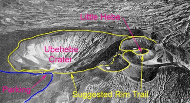
Ubehebe Crater and associated maars. Image courtesy BackRoadsWest blog. http://www.backroadswest.com/deathvalley/Ubehebe.htm
Ubehebe Craters
The Ubehebe Craters are an isolated group of cinder cones and maars created by a short volcanic episode some 2,100 years ago. Analysis in 2012 suggests the eruptive sequence may be as recent as 800 years, though this number is a lower bound rather than a precise date. There are at least a dozen craters within a 3 km2 area. Initial eruptions created scoria cones. They were quickly followed by phreatic and phreatomagmatic eruptions creating explosive craters, maars and tuff rings. There are pyroclastic surge deposits covering some 15 km2. Total coverage by ash and tephras is 40 km2.
Older small nearby maars date between 5,000 – 3,000 years ago
Ubehebe Crater itself is 0.8 km wide and 235 m deep. The field is located in Death Valley, some 225 km NW of Las Vegas. Based on the recent activity, this field is classed as still active and a moderate threat. The word Ubehebe is a local native word meaning “big basket in the rock.”
Magma rose through a fault along the western base of neighboring mountains. This fault was involved in uplift of the local mountain range. The water table sits some 150 m below the surface.

Cima Volcanic Field cinder cone. Image courtesy Kevin Palmer. https://kevin-palmer.photoshelter.com/image/I0000L7rOGAxfyPE
Cima Volcanic Field
Cima volcanic field is in San Bernardino Country 125 km SW Las Vegas. It covers 600 km2 within the Mojave National Preserve. It has at least 40 volcanic cones and 60 lava flows.
Activity took place in five phases. It began 7.6 Ma, paused 3 – 1 Ma, and continued to the most recent eruption 15,000 years ago that created the Black Tank cone. That eruptions was formerly thought to be much more recent.
There are human petroglyphs on the lava flows.
Erupted materials are primarily basalts. Lengths are just over 9 km with thickest being 4 m. Older flows are eroded. There are tephras throughout the field.
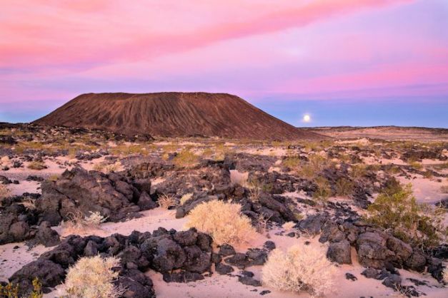
Amboy Crater. Image courtesy Wikimedia Commons. https://commons.wikimedia.org/wiki/File:Amboy_Crater_Area_of_Critical_Environmental_Concern,_California_(15039266973).jpg
Amboy Volcanic Field
Amboy Crater is located in the eastern Mojave Desert. It is 75 m high and is surrounded by a 70 km2 lava field. It is estimated to be 79,000 years old. It hosted lava lakes during its eruptive sequence and is composed of at least four cinder cones built during at least six eruptive phases.
The crater was a popular site along the old Route 66. It was also used for a scene in the 1959 Journey to the Center of the Earth. It is a National Natural Landmark in the Mohave Trails National Monument. The Lavic Lake volcanic field is located some 60 km to the west of Amboy.

Lavic Lake volcanic field. Image courtesy Wikipedia. https://en.wikipedia.org/wiki/Lavic_Lake_volcanic_field
Lavic Lake Volcanic Field
Lavic Lake is another monogenetic volcanic field in the Mojave Desert, in San Bernardino County, CA. It has four recent cinder cones, one of which is named the Pigsah Crater that dates 25,000 years ago. The most recent activity may be as recent as 10,000 years ago. Cinder cones are around 100 m above the desert floor.
Eruptive materials are basalt with predominantly pahoehoe lavas. One lobe travelled as far as 18 km from the vent.

Pigsah Crater. Image courtesy Wikipedia. https://en.wikipedia.org/wiki/Pisgah_Crater
Pigsah Crater has been mined as a source of road aggregate, significantly changing the original shape of the cone. It erupted at least times during its period of activity. Most of the final cinder cone is pyroclastic materials from the final eruption.
There is another young undated cinder cone and lava field in the Lava Beds Mountains, south of Pigsah Crater.

Crater Mountain in Big Pine volcanic field from Fish Springs Rd. Image courtesy Wikimedia Commons. https://commons.wikimedia.org/wiki/File:Big_Pine_volcanic_field_-_Crater_Mountain_from_Fish_Springs_Rd.JPG
Big Pine Volcanic Field
Big Pine volcanic field is located in Inyo County, CA. It covers 500 km2 in the Owens Valley west of the Sierra Nevada. It has lava flows, a rhyolitic coulee, and 40 vents. Some of these are cinder and scoria cones. Volcanic activity began 1.2 Ma. The youngest eruptions produced scoria cones and lava flows 17,000 years ago. It is also known as the Aberdeen volcanic field.
Lavas are primarily aa and pahoehoe. Lava flows are as long as 9 km with the thickest being 30 m. Erupted lavas are primarily basaltic.
Big Pine is no longer thermally active. Coso volcanic field to the south is geothermally active. Both fields are still considered hazardous.
Volcanic activity is tied to faulting due to Basin and Range extension. Eruptions appeared to be suppressed due to glacial coverage.

Coso Volcanic Field. Image courtesy Smithsonian GVP. https://volcano.si.edu/volcano.cfm?vn=323180
Coso Volcanic Field
The Coso volcanic field is also in Inyo County, CA at the western edge of the Basin and Range Province. Volcanic activity began millions of years ago, took a 1.5 Ma hiatus, and has been active for at least the last 1.5 Ma. It is notable for bimodal basalt and rhyolite domes and flows. Most recent activity was 30,000 – 40,000 years ago.
There are 38 rhyolite domes and lava flows in an 8 x 20 km area. Obsidian is locally exposed. Native American Coso People used obsidian to make knives, projectile points and other tools.

Coso volcanic field. Photo courtesy Forrest Hopson, FLickr. https://www.flickr.com/photos/44740122@N08/23721919829/
The magma reservoir is located 8 km below the surface and kept hot by mantle-derived basalt rising in response to Basin and Range extension. A 2000 paper by Manley and Bacon suggests that the reservoirs beneath Coso is migrating upwards over time. As with other volcanic fields, slow regions beneath the field typically are used to identify the location of the magma reservoir. Coso appears to have two magma reservoirs, one beneath the field and one 30 km south.

Schematic of Coso Volcanic Field. Image courtesy US Press. https://publishing.cdlib.org/ucpressebooks/view?docId=ft6v19p151&chunk.id=d0e10705&toc.depth=1&toc.id=d0e10705&brand=ucpress
Heat flow into and from the reservoir is described anomalously high, comparable with other known caldera-forming systems. Total magma volume of the primary reservoir is thought to be in the range of a few hundred km3, giving this system the potential for voluminous pyroclastic eruptions
There is a second slow region 30 km south of the Coso field. This may identify a neighboring or perhaps related magma reservoir. This one appears to be layered, less than 5 km from the surface. Total volume of the region is perhaps 600 km3.
The field is an active geothermal area with fumaroles along faults bounding the rhyolite capped area. This zone has been exploited for geothermal generation since 1980. It currently produces 270 MW.
It is one of the most seismically active regions in the US. Earthquake swarms are common.
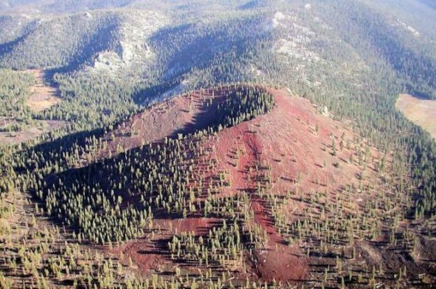
Golden Trout Creek volcano. Image courtesy Smithsonian GVP. https://volcano.si.edu/volcano.cfm?vn=323170
Golden Trout Volcanic Field
This is a group of basaltic cinder cones and lava flows in the Toowa Valley of the Sierra Nevada south of Mount Whitney, CA. Eruptions began 743,000 years ago. A second cone erupted 176,000 years ago. Most recent lava flow is thought to be 10,000 – 5,000 years old. Two of the lava flows traveled as far as 10 km from their source.

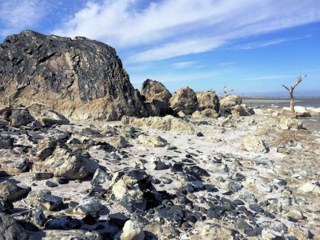
Mud volcano at Salton Buttes. Image courtesy Coachella Valley.com. http://coachellavalley.com/mud-volcanoes/
Salton Buttes
The Salton Buttes are a group of five small lava domes on the SE shoreline of the Salton Sea in Imperial County, CA. They are the only active volcanoes in southern California and are associated with the Salton Sea geothermal zone, located in the Salton Trough on the north margin of the Brawley seismic zone. The Wiki suggests they are associated with the northern migration of the East Pacific Rise.
Red Island was formed from two rhyolite domes some 8,500 years ago. A 2012 study suggests they are far more recent at 940 BC and 0 AD. Older domes buried by erosion debris from the Colorado River have been discovered during geothermal drilling.

Salton Buttes from the north. Salton Sea is in the foreground. Image courtesy Smithsonian GVP. https://volcano.si.edu/volcano.cfm?vn=323200
They lie 145 km SE of Palm Springs in the Imperial Valley. The buttes are located along the SE shoreline of the Salton Sea. Initial eruptions began some 400,000 years ago. There was a long lull until 18,000 years ago when explosive eruptions began again. Most recent eruptions started explosively and switched to effusive obsidian domes. The high heat flow of the geothermal region indicates the presence of a magma body.
The region is geologically active with frequent earthquakes and a region-wide rotten egg smell. It is also monitored in real time. The Salton Trough is still actively sinking as a result of the action of the East Pacific Rise and the opening of the Baja California rift. https://volcanoes.usgs.gov/volcanoes/salton_buttes/salton_buttes_monitoring_89.html
Salton Buttes. Image courtesy Earth Systems blog. http://www.earthsystems.com/salton-buttes/
Water levels in the Salton Sea have risen and fallen based on overall climate. The lake itself was created in 1905 when heavy rainfall reinstated Colorado River flow into the Salton Trough. Recent water level changes uncovered previously unknown fumarole fields and a number of fumarole powered mud volcanoes (gryphons and salses). The fumaroles are aligned in a NW trending line, suggesting an underlying fault.
Red Island has recently discovered active fumaroles. These are small, and were discovered based on thermal imagery.
There are three major geothermal energy sites along the SE shoreline of the Salton Sea. These have 16 total plants with a generation capacity in the 1,700 – 2,900 MW range.

Salton Sea Geothermal plants. Image courtesy CLUI. http://clui.org/ludb/site/salton-sea-geothermal-plants
Conclusions
With the Walker Lane, we have a relatively recent ongoing tectonic event in western North America. The continent is rifting, starting with Baja California. That rift progressed into southern California, where it forked. Most of the transverse motion of the Pacific Plate is expressed with the strike-slip motion along the San Andreas Fault system. Part of that motion is expressed on the east side of the Sierra Nevada, where faults are coalescing into an eastern arm of the rift, the Walker Lane.
As the motion is transverse, strike-slip, there is remarkably little volcanism (at least to me) along the western branch of the rift in North America, though there was significant volcanic activity in Mexico. However, there has been relatively recent volcanic activity along the eastern branch, the Walker Lane, some of it substantial and highly explosive, with the Inyo – Mono – Long Valley region being the largest and most recently active. Between that region and the Salton Trough, most of the volcanic activity has been monogenetic, though there is no shortage of rhyolite activity.
As portions of North America transfer to the Pacific Plate, it remains to be seen whether that transfer will include the Sierra Nevada or not. The other question is where will the Walker Lane connect to the remaining Pacific Plate: The Shasta – Lassen region? Further up the Cascades? Somewhere else?

Red Hill volcano hike, Coso volcanic field. Image courtesy Richard Kinney, YouTube.
https://www.youtube.com/watch?v=ZJe5K3ca_Og
Additional Information
http://www.geology.cwu.edu/facstaff/lee/publications/pdf.papers/GSAPenrose.06.pdf
http://neotectonics.seismo.unr.edu/CNS_pdfs/2004TC001645.pdf
http://neotectonics.seismo.unr.edu/CNS_pdfs/WesnouskyinJSG%202005.pdf
https://openei.org/wiki/Walker-Lane_Transition_Zone_Geothermal_Region
http://geoprisms.org/wp-content/uploads/2015/03/RIE2010_WP_Busby_Walker_Lane_white_paper.pdf
https://volcanoes.usgs.gov/volcanoes/mono_inyo_craters/geo_hist_summary.html
https://volcanoes.usgs.gov/volcanoes/mono_inyo_craters/
http://www.indiana.edu/~sierra/papers/2008/nahler.html
http://www.indiana.edu/~sierra/papers/2008/young.pdf
https://volcano.si.edu/volcano.cfm?vn=323160
https://volcanoes.usgs.gov/volcanoes/salton_buttes/
https://volcano.si.edu/volcano.cfm?vn=323200
http://www.geol.ucsb.edu/faculty/busby/library/pdf/Busby%20et%20al%20Hopson%202008.pdf
https://www.tandfonline.com/doi/full/10.1080/00206810902978265
https://volcanoes.usgs.gov/volcanoes/lavic_lake/
https://www.sciencedirect.com/science/article/pii/S0377027317300203
https://archive.org/stream/recentvolcanisma76park/recentvolcanisma76park_djvu.txt
https://academic.oup.com/petrology/article/41/1/149/1422795


.jpg)
M 4.5 earthquake last night in Anchorage. Nice jolt and the house swayed a while afterwards. Cheers –
https://www.adn.com/alaska-news/2018/10/14/earthquake-shakes-anchorage-southcentral-alaska/
LikeLiked by 1 person
I’m wondering where exactly this is?
“There is a second slow region 30 km south of the Coso field. This may identify a neighboring or perhaps related magma reservoir. This one appears to be layered, less than 5 km from the surface. Total volume of the region is perhaps 600 km3.”
I live within sight of the Coso fields, directly south. The recent large earthquakes and subsequent earth splitting here have made me aware of local volcanic possibilities, so I’m curious. Thank you for your explanation of the Walker Lane, it helped me understand the nature of the places I’ve lived most of my life.
LikeLike
Howdy EMR – as far as I can tell, it is south of China Lake a bit. While I’ve seen the region a few times from the air many years ago, I don’t have local experience like you do. There appears to be a lot of magma not so far below the surface in the Coso region, not unlike Sorocco in NM. What it does is anyone’s guess. Thank you for looking into VH. Cheers –
LikeLiked by 1 person
Thanks for your reply! You might like to know after I posted this question I found out that GPS monitors showed a decline in the Coso Field and uplift to the south (under Ridgecrest) starting several days before the quake sequence. From what I understand, uplift continues. Something to watch!
LikeLike
Pingback: Mono-Inyo Craters – the Most Recent Activity at Long Valley, CA |
Pingback: Golden Trout Creek, California, USA |